STORM Pages
Since 1989 the Save The Oak Ridges Moraine Coalition has focused on protecting the ecological integrity of the Oak Ridges Moraine through grassroot efforts.
Save The Oak Ridges Moraine Coalition
The Save The Oak Ridges Moraine (STORM) Coalition has been dedicated to protecting the ecological integrity of the Oak Ridges Moraine since 1989.
To complement our main website (stormcoalition.com), our GitHub repository hosts STORM’s GitHub Pages—an open space where we share ideas, knowledge, references, mapping resources, and technology.
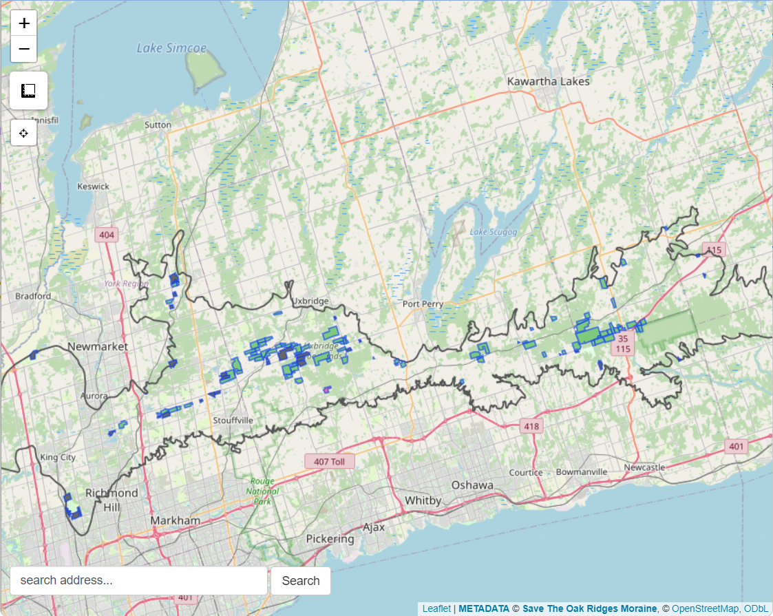
Maps
STORM has invested significant effort in developing interactive online mapping tools that inform and educate the public about the many functions of the Oak Ridges Moraine and the legislative measures designed to protect it. These maps also help us gather and coordinate insights contributed by our members and concerned citizens. Continuously updated, they serve as a dynamic platform for communication and awareness focused on the Moraine.
We welcome all feedback—whether you need guidance on using the tools or have suggestions for new features. Through this work, STORM aims to re-energize community engagement in protecting the Oak Ridges Moraine.
Data sources used for the maps are provided below*
Moraine Watch map
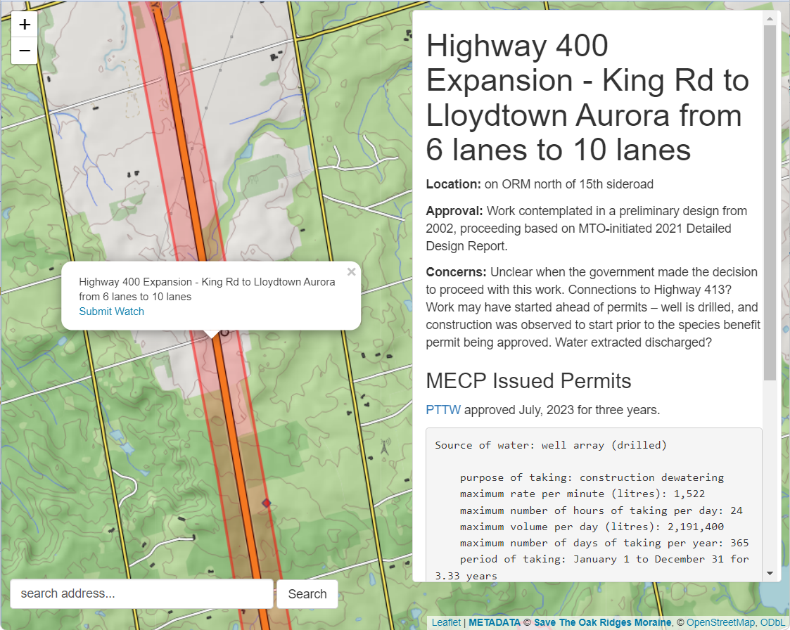
This is the home mapping tool designed to assist the Moraine Watch program. The intention of this map is to provide many interactive resources to concerned citizens who are concerned with land use changes occurring atop the Oak Ridges Moraine.
Share the QR code below for access on your smart devices:

Oak Ridges Moraine Conservation Plan map
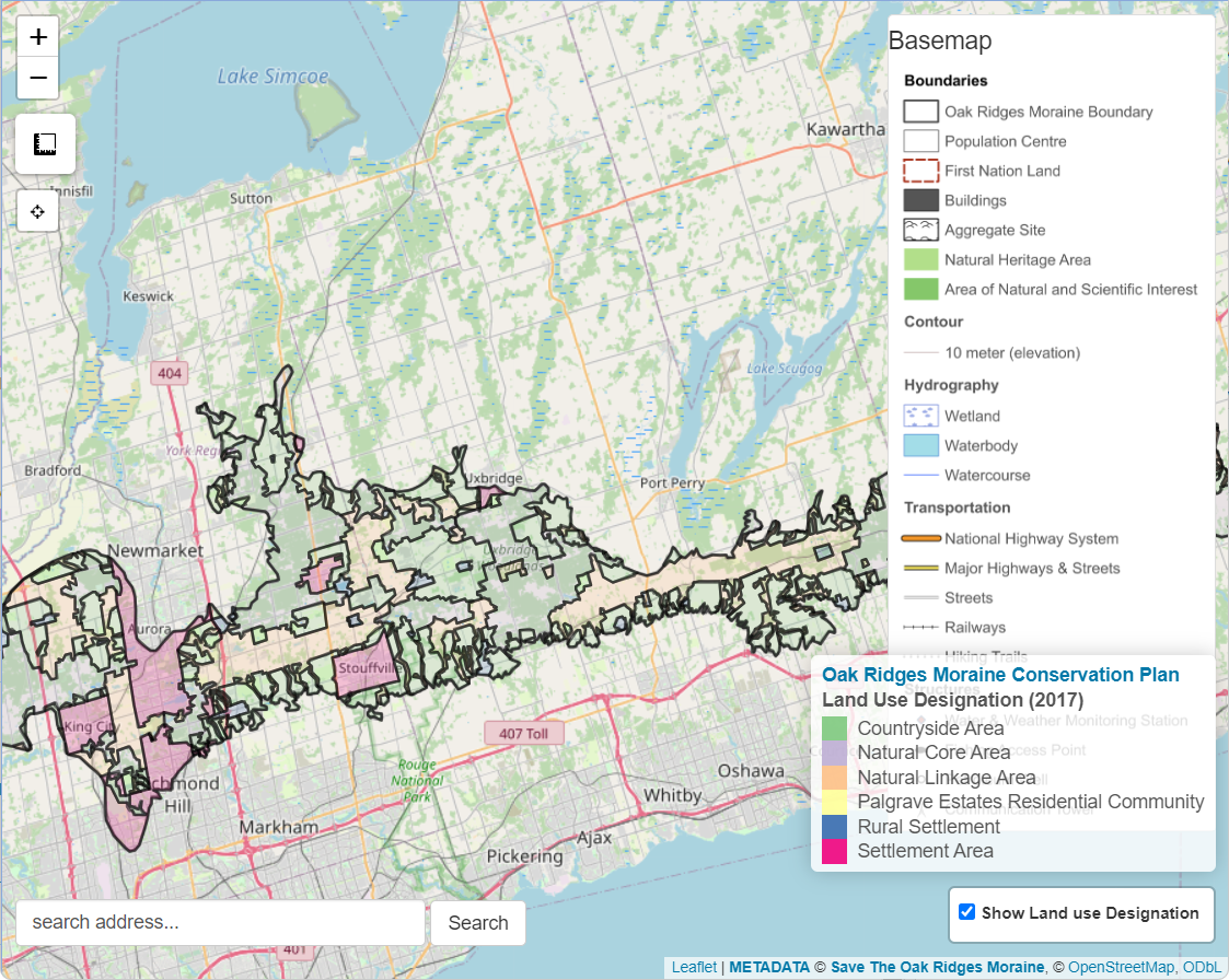
The Oak Ridges Moraine Conservation Plan map presents the land use designation as defined by the 2017 plan.
Jurisdiction
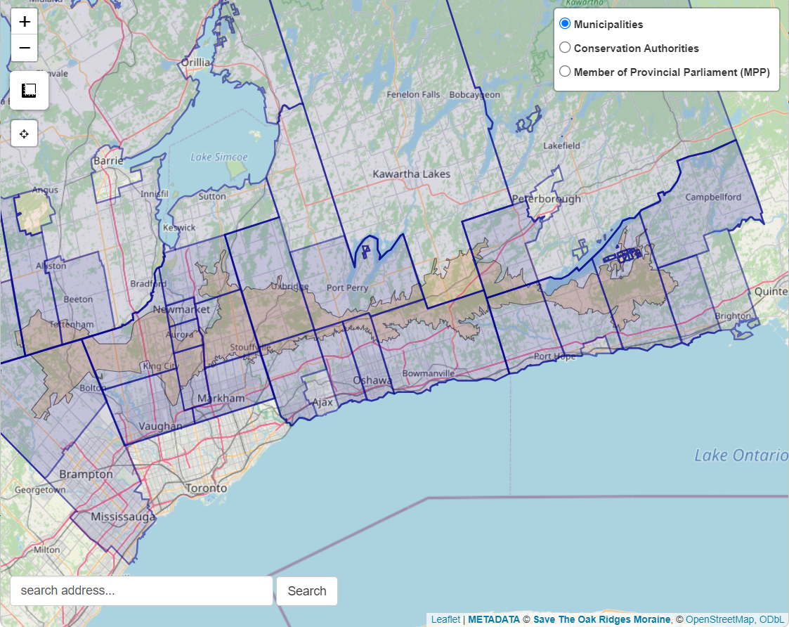
The jurisdiction map shows all the public agencies that share some part of the Oak Ridges Moraine. This includes:
- Municipalities (both upper and lower tiers)
- Conservation Authorities
- Provincial Ridings
Policy
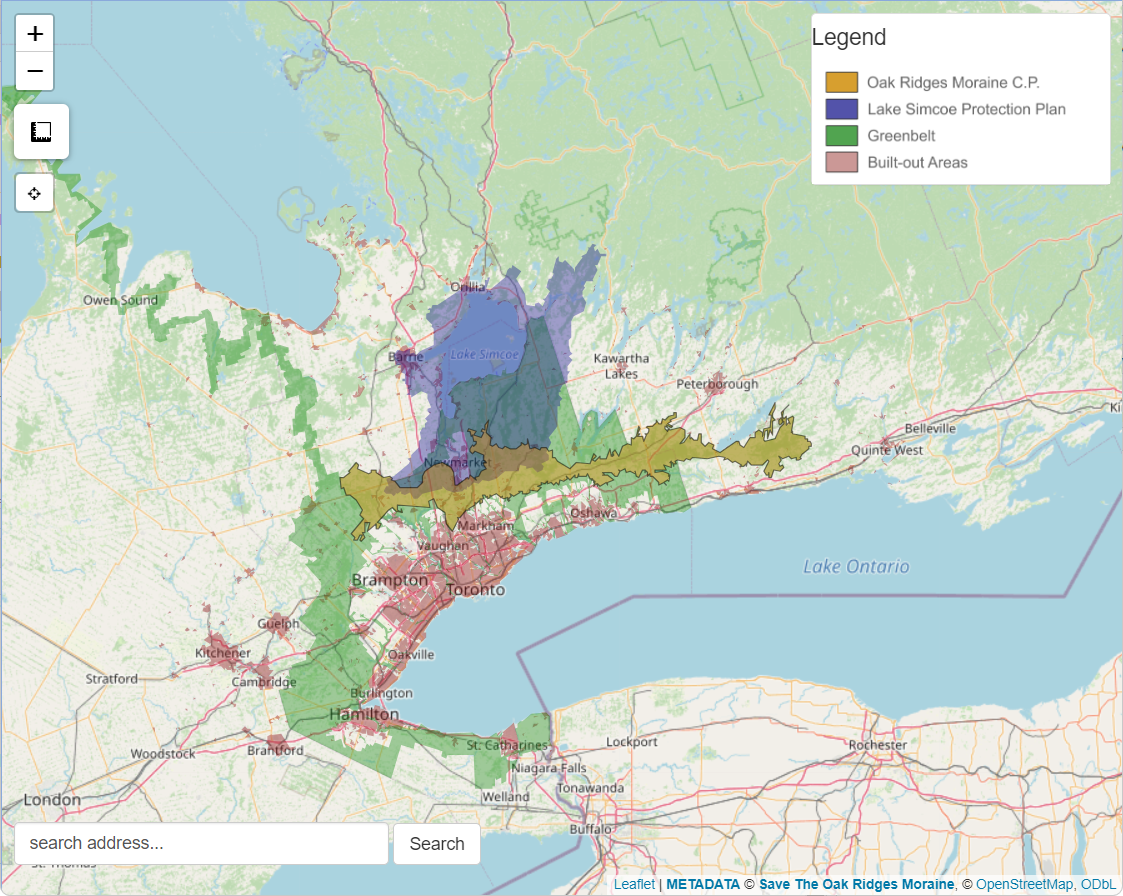
The policy map shows all the public agencies that share some part of the Oak Ridges Moraine. This includes:
- Oak Ridges Moraine Conservation Plan (2017)
- Niagara Escarpment Plan (2017)
- Greenbelt Plan (2017)
- Lake Simcoe Protection Plan (2009)
Natural Resources
The natural resource map shows a multitude of resource extraction and agricultural activities on the Oak Ridges Moraine such as active and inactive aggregate operations occurring in the Oak Ridges Moraine area.
Map Features
- Custom ORM “basemap”: provides specialized geographic details needed to determine local features at risk.
- Geo-locator: let your devices’ GPS identify your location.
- Address locator: discover a location by entering an address.
- Measurement tool: determine either lengths or areas by clicking on the interactive maps.
- click anywhere to gather coordinates and provide pre-filled emails for Moraine Watchers to submit a actions of concern.
More info
The Oak Ridges Moraine
The Oak Ridges Moraine is one of Ontario’s largest moraines, it extends 160 kilometres from the Niagara Escarpment in the west to the Trent River system in the east, and is on average 13 kilometres wide.
Longitudinal Analysis
A longitudinal analysis is the study of how geographic features or environmental conditions change over time by comparing spatial data from multiple points in the past.
STORM history
The idea for a coalition on the Oak Ridges Moraine flowed out of a meeting in October 1989 of community-based groups and individuals concerned about development pressures in different areas of the Oak Ridges Moraine.
Data sources
All geospatial data hosted on STORM’s maps come from open federal, provincial and municipal data repositories. All data are freely available and are referenced in detail on our Map data sources page.
STORM strives to maintain an open and transparent access to the data we post online. Any data sets either produced by us or derived from external public data sets are hosted on GitHub here. These data are free to use under the Creative Commons CC-BY-SA-4.0 license.